




Þingeyjarsveit photos
31 Photos
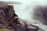
Dettifoss waterfall, 100 m wide, 45 m high, on the river Jokulsa a Fjöllum in June 1997. The 28 km long "road" from the Ring Road to the waterfall was the worst I have ever driven with a car in 1997, a dirt and mud track with puddles up to 30 cm deep, I was glad I didn't get stuck. On the way back, I took a 150 km detour via Husavik to get back to the Ring Road.
Günther Glauz†
Günther Glauz†
Island / Regionen / Nordostland - Norand eystra
1016 800x543 Px, 26.02.2007
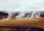
Solfatara field Namaskardi 6 km east of Lake Myvatn on the Ring Road in June 1997, with mud pots, steam columns, and the smell of sulfur. Leaving the marked paths is dangerous; you can break through, and underneath it can be up to 200 degrees hot!
Günther Glauz†
Günther Glauz†
Island / Regionen / Nordostland - Norand eystra
984 800x575 Px, 26.02.2007
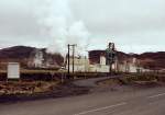
Northeast of Lake Myvatn, diatomaceous earth was mined and processed into diatomite at this plant, which is environmentally controversial. According to Wikipedia, the plant has since been closed and dismantled. Photographed in June 1997.
Günther Glauz†
Günther Glauz†
Island / Regionen / Nordostland - Norand eystra
988 800x563 Px, 25.02.2007
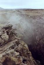
Fissure near Lake Myvatn, formed by the drifting apart of the North American and Eurasian tectonic plates, which can move up to 20 cm per year. The gap is filled with magma, which rarely reaches the Earth's surface, but water can penetrate and evaporate due to heating.
Günther Glauz†
Günther Glauz†
Island / Regionen / Nordostland - Norand eystra
1226 409x600 Px, 25.02.2007
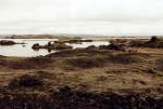
Myvatn Lake (German: Mückensee) in northeastern Iceland in June 1997, the lake does not freeze over in winter and is quite rich in fish, but also known for its abundance of midges in summer.
Günther Glauz†
Günther Glauz†
Island / Regionen / Nordostland - Norand eystra
891 800x544 Px, 25.02.2007