




Photos by Maik Junghanns
11 Photos
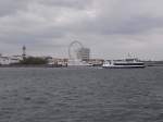
View of Warnemünde with lighthouse, Teepott, Hotel "Neptun" and the newly installed Ferris wheel right on the beach.
In the foreground, the passenger ship "Rostocker7" turning into the Alten Strom in Warnemünde.
The passenger ship "Baltica" is already securely moored at the berth.
Maik Junghanns
In the foreground, the passenger ship "Rostocker7" turning into the Alten Strom in Warnemünde.
The passenger ship "Baltica" is already securely moored at the berth.
Maik Junghanns
Deutschland / Mecklenburg-Vorpommern / Landkreis und Stadt Rostock
1665 1024x768 Px, 03.05.2010
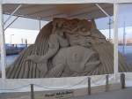
1. Warnemünde Sand World, an exhibition of international artists who create sand sculptures. Tents were set up around the figures to protect them from rain. The location is Warnemünde, right next to the ferry terminal to Hohe Düne, on the grounds belonging to the strawberry farm "Karl's".
On the right side of the image, seen through the tent, is the Hohe Düne Marina Residence.
Maik Junghanns
Maik Junghanns
Deutschland / Mecklenburg-Vorpommern / Landkreis und Stadt Rostock
2030 1024x768 Px, 15.04.2010
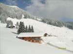
View towards the summit of Hohe Salve (1829m), the highest mountain in the Wilder Kaiser/Brixental ski area
Maik Junghanns
Maik Junghanns
ֳterreich / Tirol / Kitzb�r Alpen
1420 800x600 Px, 24.02.2009
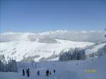
View of the snow-covered mountain landscape of the Tyrolean Alps towards Scheffau / Ellmau in the Wilder Kaiser ski area.
Maik Junghanns
Maik Junghanns
ֳterreich / Tirol / Kitzb�r Alpen
1624 800x600 Px, 24.02.2009
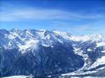
Austria, state of Tyrol, Zillertal, Finkenberg,
View from approximately 2400m above sea level into the Tux Valley and towards the Hintertux Glacier (3476m)
Photo taken on 22.03.2008
Maik Junghanns
Maik Junghanns
ֳterreich / Tirol / Zillertal
1162 800x600 Px, 03.04.2008
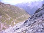
Italy - South Tyrol
View from 2758 meters down into the valley at the hairpin bends leading to the Stelvio Pass. A total of 48 hairpin bends and 27 km of uphill only.
Maik Junghanns
Maik Junghanns
Italien / Norditalien / S�rol
1217 800x600 Px, 31.07.2007
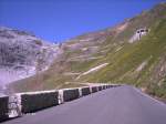
Italy - South Tyrol
Blick hinauf zum Stilfser Joch (2758m). Insgesamt 27 km und 48 Kehren!
Maik Junghanns
Blick hinauf zum Stilfser Joch (2758m). Insgesamt 27 km und 48 Kehren!
Maik Junghanns
Italien / Norditalien / S�rol
1488 2 800x600 Px, 31.07.2007
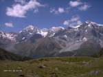
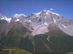
Italy - South Tyrol
View of the Ortler mountain range.
On the right, the Ortler (3905m), in the center the Zebru (3735m), on the left the Königspitze (3859m).
Maik Junghanns
View of the Ortler mountain range.
On the right, the Ortler (3905m), in the center the Zebru (3735m), on the left the Königspitze (3859m).
Maik Junghanns
Italien / Norditalien / S�rol
1545 800x600 Px, 31.07.2007
Italien / Norditalien / S�rol
1022 800x600 Px, 31.07.2007
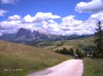
Italy - South Tyrol
View from the hiking loop trail "Puflatsch" over part of the Seiser Alm and towards the Marmolada as well as the Langkofel (left/3181m) and the Plattkofel (right/2955m).
Maik Junghanns
View from the hiking loop trail "Puflatsch" over part of the Seiser Alm and towards the Marmolada as well as the Langkofel (left/3181m) and the Plattkofel (right/2955m).
Maik Junghanns
Italien / Norditalien / S�rol
1479 800x600 Px, 31.07.2007
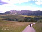
Italy - South Tyrol
View of the Seiser Alm and in the background the mountain range of the Schlern massif (2564m).
Maik Junghanns
Maik Junghanns
Italien / Norditalien / S�rol
1107 800x600 Px, 31.07.2007