landschaftsfotos.eu Linie landschaftsfotos.eu
Hello guest, you are not logged in. Log in | Create account 
Forum   Contact   Legal notice
German English 

Photos by Jiri Zanka
32 Photos
View of the Vltava from the Žďák Bridge. The Vltava Bridge Žďákov, Czech Žďákovský most, is a road bridge that carries State Road I/19 Pilsen – Tabor over the Orlík Reservoir of the Vltava River between the towns of Orlík nad Vltavou and Kostelec nad Vltavou in the Písek District in the Czech Republic. 26.6.2021.
Jiri Zanka

Tschechien / Landschaften / Mittelb�n

296 1200x901 Px, 27.07.2021

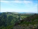
The Ostaš (German Wostasch, also Ostasch) is a table mountain in the central Sudetes in the Náchod region of the Czech Republic. The total area of the region, which rises from 640 to 700 meters, is 29.5 hectares. It is located about two kilometers northwest of the town of Police nad Metují. 31.7.2018.
Jiri Zanka

Tschechien / Landschaften / Braunauer Bergland

306 1200x900 Px, 14.03.2021

The Luční bouda (German: Wiesenbaude) is a mountain hut in the Czech part of the Giant Mountains. It is located on the White Meadow in the source area of the Bílé Labe (White Elbe) at 1,410 meters, 3 kilometers west of the Schneekoppe and about 500 meters south of the Polish-Czech border. 22.6.2017
Jiri Zanka

Tschechien / Landschaften / Riesengebirge

259 1200x901 Px, 21.09.2020

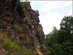
Černolické skály (also Devil's Rocks) is a rock massif composed of massive Ordovician quartz, rising above the village of Černolice in the Prague-West district. 5.7.2017
Jiri Zanka

Tschechien / Landschaften / B�sches Mittelgebirge

296 1200x901 Px, 21.09.2020

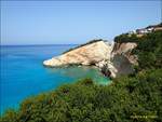
Porto Katsiki - Island of Lefkada (Greece) on 10.7.2019.
Jiri Zanka

Griechenland / Inseln / Lefkada

288 1200x901 Px, 26.08.2019

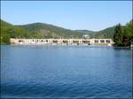
Slapy Dam on the Vltava River with hydroelectric power plant on 23.8.2017.
Jiri Zanka

Tschechien / Landschaften / B�sches Mittelgebirge

473 1200x901 Px, 10.09.2017

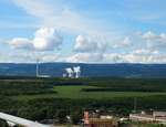
View of the Prunerov power plant and Krusne hory - Ore Mountains. Excursion on 3rd September 2017.
Jiri Zanka

Tschechien / Landschaften / Krusne hory (Erzgebirge)

481 1200x920 Px, 10.09.2017

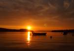
After sunset at Cres on 13.9.2015.
Jiri Zanka

Galerien / Stimmungsbilder / Sonnenunterg䮧e

559 1200x842 Px, 09.10.2015

Sunset at Cres on 11.9.2015.
Jiri Zanka

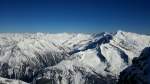
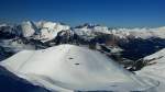
Zillertal Alps from the Hintertux Glacier (Gefrorene Wand 3250m) on 28.3.2015.
Jiri Zanka

ֳterreich / Tirol / Zillertal

653 1200x674 Px, 18.04.2015

Zillertal Alps from the Hintertux Glacier (Gefrorene Wand 3250m) on 28.3.2015.
Jiri Zanka

ֳterreich / Tirol / Zillertal

662 1200x674 Px, 18.04.2015

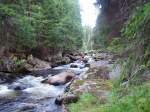
The Křemelná (German Kieslingbach, Kiesleitenbach) is a 30.3 km long river in the Bohemian Forest, Czech Republic. The Křemelná originates about 6 km north of Železná Ruda at the foot of the Pancíř (1214 m) and Můstek (Brückelberg, 1234 m) mountains at an elevation of 1090 m in the extensive spring bog Šmauzy (Schmausen, nature reserve). 28.7.2007
Jiri Zanka

Tschechien / Landschaften / B�rwald

797 1200x900 Px, 14.03.2014

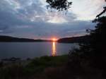
Sunset at Lipno on 14.8.2013.
Jiri Zanka

The Lipno Reservoir is a lake in the southwest of the Czech Republic, part of the Vltava Cascade and forms its fourth oldest and highest stage. It is located on the border with Austria in the Bohemian Forest National Park and landscape protection area in the Okres Český Krumlov (Krumau district), with only a small extension of the lake in the northwest lying in the Okres Prachatice (Prachatitz district), and a very small part in the southwest on Austrian territory (Rohrbach district, Upper Austria).
Jiri Zanka

Tschechien / Landschaften / B�rwald

703 1200x902 Px, 13.03.2014

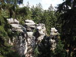
The Prachovské skály (German: Prachauer Felsen) are located in the far east of the Bohemian Paradise (Český ráj), south of the Turnov-Jičín road and north of the Mladá Boleslav-Jičín road.
Jiri Zanka

Tschechien / Landschaften / Region Liberec

754 1200x900 Px, 13.03.2014

Czech Grand Canyon - Great America. Former limestone quarry and between 1949 and 1953 penal quarry  Limestone Hell . 1.9.2012.
Czech Grand Canyon - Great America. Former limestone quarry and between 1949 and 1953 penal quarry "Limestone Hell". 1.9.2012.
Jiri Zanka

Tschechien / Landschaften / B�sches Mittelgebirge

1375 1200x903 Px, 24.01.2014

¦Pik des Rechts is a 2473m high mountain in Upper Carniola in the Julian Alps in Slovenia. The mountain got its name (¨pik = peak) due to its distinctive shape.
Jiri Zanka

Slowenien / Julischen Alpen / Jelovica

1154 1200x900 Px, 23.11.2013

Sunset at Cres on 17.9.2012.
Jiri Zanka

Kroatien / K�nregion / Inseln

985 1024x709 Px, 21.03.2013

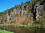
Svatoš Rocks on April 27, 2012. Between Loket (Elbogen) and Karlovy Vary, the Eger River flows through the deeply incised Hans-Heiling Valley. Blue hiking trail.
Jiri Zanka

Tschechien / Landschaften / B�n

1091 1024x768 Px, 21.01.2013

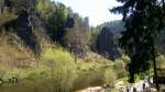
Svatoš Rocks on April 27, 2012. Between Loket (Elbogen) and Karlovy Vary, the Eger River flows through the deeply incised Hans-Heiling Valley. Blue hiking trail.
Jiri Zanka

Tschechien / Landschaften / B�n

929 1024x575 Px, 21.01.2013

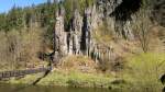
Svatoš Rocks on April 27, 2012. Between Loket (Elbogen) and Karlovy Vary, the Eger River flows through the deeply incised Hans-Heiling Valley. Blue hiking trail.
Jiri Zanka

Tschechien / Landschaften / B�n

931 1024x575 Px, 21.01.2013

Grand Baie Bay on 16.11.2009. Mauritius.
Jiri Zanka

Mauritius / Grand Baie / Landschaften

808 1024x768 Px, 21.11.2012

Sunset at Merville Beach on 15.11.2009. Mauritius.
Jiri Zanka

Mauritius / Grand Baie / Landschaften

907  6 1024x768 Px, 21.11.2012

On the beach of Merville Beach in Grand Baie on 12.11.2009. Mauritius.
Jiri Zanka

Mauritius / Grand Baie / Landschaften

806 1024x768 Px, 21.11.2012