landschaftsfotos.eu Linie landschaftsfotos.eu
Hello guest, you are not logged in. Log in | Create account 
Forum   Contact   Legal notice
German English 

Photos by André Breutel
744 Photos
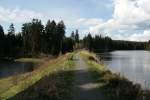
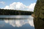
Oberharzer Wasserregal - Um für die trockenen Jahreszeiten unendliche Wasserreserven zu haben, wurden über 500 Kunstteiche gebaut. Das oberste Gestz lautete,  Erst das fließende Wasser gebrauchen, dann auf das stehende Wasser zurückgreifen!  Hier im Bild: Nassenwieser Teich bei Clausthal-Zellerfeld.
Oberharzer Wasserregal - Um für die trockenen Jahreszeiten unendliche Wasserreserven zu haben, wurden über 500 Kunstteiche gebaut. Das oberste Gestz lautete, "Erst das fließende Wasser gebrauchen, dann auf das stehende Wasser zurückgreifen!" Hier im Bild: Nassenwieser Teich bei Clausthal-Zellerfeld.
André Breutel

Deutschland / Niedersachsen / Harz

732  1 700x467 Px, 05.06.2008

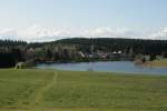
Oberharzer Wasserregal - Am Beispiel des Bärenbrucher Teichs und Ziegenberger Teichs wird der Name  Wasserregal  deutlich. Wie ein Regal waren die Bauwerke übereinander angebracht. Das Wasser wurde auch nach dem Gebrauch aufgefangen und der nächsten Maschine zugeführt. Somit konnten viele Anlagen über- und untertage mit dem gleichen Wasser betrieben werden. Welcher Energieträge kann noch so effektiv genutzt werden?
Oberharzer Wasserregal - Am Beispiel des Bärenbrucher Teichs und Ziegenberger Teichs wird der Name "Wasserregal" deutlich. Wie ein Regal waren die Bauwerke übereinander angebracht. Das Wasser wurde auch nach dem Gebrauch aufgefangen und der nächsten Maschine zugeführt. Somit konnten viele Anlagen über- und untertage mit dem gleichen Wasser betrieben werden. Welcher Energieträge kann noch so effektiv genutzt werden?
André Breutel

Deutschland / Niedersachsen / Harz

561 700x467 Px, 05.06.2008

Oberharzer Wasserregal - Blick über den Ziegenberger Teich zum Sumpfteich bei Buntenbock.
André Breutel

Deutschland / Niedersachsen / Harz

666 700x467 Px, 05.06.2008

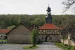
No. 86 - Michaelstein Monastery. The monastery with its fish ponds and herb garden is located near Blankenburg/Harz. It is known for its collection of musical instruments and as a center for further education and research in musical performance practice.
André Breutel

Galerien / besondere Themen / Harzer Wandernadel

604 700x467 Px, 03.06.2008

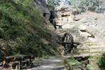
No.82 - Regenstein Mill. North of Blankenburg/Harz lies the cascade-arranged Regenstein Mill. It dates back to the 12th century and was reconstructed after excavations.
André Breutel

Galerien / besondere Themen / Harzer Wandernadel

1312 700x467 Px, 03.06.2008

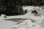
No.81 - Sand caves in the Heers. This is also the Harz! Below the Regenstein castle ruins, north of Blankenburg/Harz, are the sand caves. The caves were a cult site and assembly place (Thingplatz) of the Germanic peoples in early historical times. Currently, they are the filming location for Til Schweiger's new movie.
André Breutel

Galerien / besondere Themen / Harzer Wandernadel

1088 700x467 Px, 03.06.2008

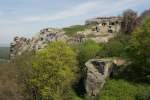
No. 80 - Regenstein Castle Ruins. The remains of the castle, first mentioned in 1169, are located on a prominently visible sandstone rock north of Blankenburg/Harz.
André Breutel

Galerien / besondere Themen / Harzer Wandernadel

592 700x467 Px, 03.06.2008

No.46 - Border Museum at the Ring of Remembrance. On the inner-German border, near Sorge, is the Ring of Remembrance and the Border Museum.
André Breutel

Galerien / besondere Themen / Harzer Wandernadel

608 700x467 Px, 03.06.2008

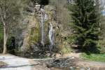
No.40 - Königshütte Waterfall. In the district of Rothehütte, at the railway bridge of the Rübeland Railway over the B 27, there is a beautiful rest area with the 20m high waterfall. Due to the prolonged drought, it is currently a bit weak.
André Breutel

Galerien / besondere Themen / Harzer Wandernadel

959 700x467 Px, 03.06.2008

No. 116 - Engagement Island in the Oker. Between huge boulders in the wild and romantic Oker Valley lies Engagement Island, which can be reached via a wooden bridge. There is one of the most beautiful white-water sections in Germany. Above Engagement Island is Romkerhall, a popular excursion destination with a 65 m high waterfall, the highest in the Harz.
André Breutel

Galerien / besondere Themen / Harzer Wandernadel

1234 700x467 Px, 16.05.2008

No. 113 - Grumbacher Pond. The actual name is Lower Grumbacher Pond. It is one of four  Grumbacher Ponds  that belonged to the  Upper Harz Water Regale.  The artificially created ponds between Hahnenklee and Wildemann stored the supply water for the water wheels in the mining area of Wildemann.
No. 113 - Grumbacher Pond. The actual name is Lower Grumbacher Pond. It is one of four "Grumbacher Ponds" that belonged to the "Upper Harz Water Regale." The artificially created ponds between Hahnenklee and Wildemann stored the supply water for the water wheels in the mining area of Wildemann.
André Breutel

Galerien / besondere Themen / Harzer Wandernadel

668 700x467 Px, 16.05.2008

No. 112 - Love Bench. The Liebesbankweg near Hahnenklee is a leisurely hiking trail that leads from the Bocksberg to the Upper Harz town. The path is equipped with several artistically designed benches for resting. From the benches, you have a fantastic view over the Upper Harz into the Fore Harz region near Goslar.
André Breutel

Galerien / besondere Themen / Harzer Wandernadel

781 700x467 Px, 16.05.2008

No. 14 - Schnarcherklippe. The Schnarcherklippen are two famous 28 m high granite outcrops south of Schierke. They produce sounds resembling snoring when there is a southeast wind.
André Breutel

Galerien / besondere Themen / Harzer Wandernadel

600 700x467 Px, 16.05.2008

No. 67 - White Stag. The White Stag is a viewpoint above Treseburg. After managing the very steep ascent from Treseburg to the 150m high viewpoint, you are rewarded with a beautiful view of Treseburg, the Bodetal, and Luppbodetal.
André Breutel

Galerien / besondere Themen / Harzer Wandernadel

582 700x467 Px, 16.05.2008

No. 66 - Wilhelmsblick. The Wilhelmsblick is a viewpoint near Tresburg. From Wilhelmsblick, you can get a beautiful overview of the Bode loops near Tresburg. It is one of the most beautiful views in the area. Unfortunately, it is slowly becoming overgrown. The real highlight is the tunnel through which the hiking trail leads from the road to the viewpoint.
André Breutel

Galerien / besondere Themen / Harzer Wandernadel

606 700x467 Px, 16.05.2008

No. 65 - Todtenrode Inn. The Todtenrode Inn is located north of Altenbrak.
André Breutel

Galerien / besondere Themen / Harzer Wandernadel

578 700x467 Px, 16.05.2008

No. 64 - Böser Kleef. The Böser Kleef is a viewpoint above Altenbrak. The best way to reach Böser Kleef is from the Todtenrode Inn. After a short hike, you have a beautiful view of the Bodetal and the Harz mountain meadows opposite.
André Breutel

Galerien / besondere Themen / Harzer Wandernadel

659 700x467 Px, 16.05.2008

No. 62 - Wendefurth Dam. The Wendefurth Dam is located below the Rappbode Dam. It is used for energy production, fish farming, and flood protection. Since it is not a drinking water reservoir, it is also used for tourism.
André Breutel

Galerien / besondere Themen / Harzer Wandernadel

622 700x467 Px, 16.05.2008

No. 10 - Große Zeterklippe. The Große Zeterklippe is a rock formation in the Hochharz National Park. It is located above the Ilse spring. You are very close to the Brocken. From the Ilse valley, there is a beautiful view of the mountain. In the opposite direction, you can see the Hohneklippen. With favorable wind, you can already smell the smoke from the steam locomotives on the Brocken.
André Breutel

Galerien / besondere Themen / Harzer Wandernadel

712 700x467 Px, 16.05.2008

No. 15 - Leistenklippe. The Leistenklippe is a rock formation on the Hohnekamm. From the viewpoint on the cliff, you have a fantastic panoramic view over the Harz. The cliff can be reached on a hike from Drei-Annen-Hohen or Schierke.
André Breutel

Galerien / besondere Themen / Harzer Wandernadel

698 700x467 Px, 30.04.2008

No. 17 - Trudenstein. The Trudenstein is a granite crag on the Goetheweg. From this viewpoint, there is a beautiful panorama over the southern Harz. It is easily accessible from Drei-Annen-Hohne. It can be easily climbed via iron ladders and rewards the hiker with a stunning panorama. From here, there is a nice ascent to the Hohneklippen.
André Breutel

Galerien / besondere Themen / Harzer Wandernadel

723 700x467 Px, 30.04.2008

No. 27 - Ottofelsen. The Ottofelsen is a 36 m high granite tor in the northern Hohne area, named after Prince Otto of Stolberg-Wernigerode. It can be reached from Wernigerode via the Thumkuhlental and from Ilsenburg as well as Drei-Annen-Hohne via the Upper Hohne Trail.
André Breutel

Galerien / besondere Themen / Harzer Wandernadel

986 700x467 Px, 30.04.2008

Nr. 28 - Gasthaus Steinerne Renne. Das Gasthaus Steinerne Renne befindet sich im nördlichen Hohnegebiet. Als Steinerne Renne wird der steil ins Tal stürzende Oberlauf der Holtemme, mit vielen Wasserfällen, zwischen der Quelle und der gleichnamigen Brockenbahnstation bezeichnet. Das Gasthaus steht malerische über einem Wasserfall. Der Ursprung das Gasthauses in Form einer Baude geht ins Jahr 1869 zurück. Heute ist es ein Hotel in romatische Lage.
André Breutel

Galerien / besondere Themen / Harzer Wandernadel

854 700x467 Px, 30.04.2008

Nr. 31 - Agnesberg. Der Agnesberg liegt oberhalb vom Schloß Wernigrode.
André Breutel

Galerien / besondere Themen / Harzer Wandernadel

515 700x467 Px, 30.04.2008