landschaftsfotos.eu Linie landschaftsfotos.eu
Hello guest, you are not logged in. Log in | Create account 
Forum   Contact   Legal notice
German English 

Photos by Kurt Rasmussen
30 Photos
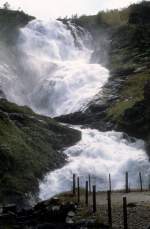
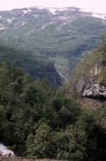
Norway, Aurland: The landscape around the Kjosfossen waterfall. Date of capture: August 4, 1982.
Kurt Rasmussen

Norwegen / Westland / Sogn og Fjordane

574 672x1024 Px, 22.06.2014

Norway, Aurland: The Kjosfossen waterfall is located 840 meters above sea level and has a drop height of 93 meters. The waterfall is only accessible by train (Flåmsbana Myrdal - Flåm). Date of capture: August 4, 1982.
Kurt Rasmussen

Norwegen / Westland / Sogn og Fjordane

670 670x1024 Px, 22.06.2014

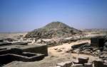
Ägypten Memphis am 25. Juni 1977: Die eingestürzte Stufenpyramide des Unas in Sakkara, das die Grabstadt von Memphis war.
Kurt Rasmussen

Afrika / ħypten / Niltal

746 1200x766 Px, 29.05.2014

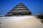
Ägypten Memphis am 25. Juni 1977: Die Pyramide des Pharao Djoser, eine sogenannte Stufenpyramide, in der Nekropole Sakkara.
Kurt Rasmussen

Afrika / ħypten / Niltal

732 1200x782 Px, 29.05.2014

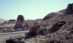
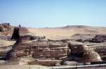
Gizeh am 14. Juni 1974: Die grosse Sfinx.
Kurt Rasmussen

Afrika / ħypten / Niltal

688 1200x722 Px, 24.05.2014

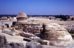
Gizeh am 14. Juni 1974: Die grosse Sfinx.
Kurt Rasmussen

Afrika / ħypten / Niltal

686 1200x789 Px, 24.05.2014

Gizeh am 14. Juni 1974: Die grosse Sfinx.
Kurt Rasmussen

Afrika / ħypten / Niltal

653 1200x784 Px, 24.05.2014

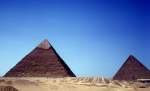
Gizeh am 14. Juni 1974: Die Chefren- und die Cheops-Pyramiden.
Kurt Rasmussen

Afrika / ħypten / Niltal

718 1200x728 Px, 24.05.2014

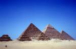
Giza on June 14, 1974: Three Queen's Pyramids stand in the foreground. Behind them are the Pyramid of Menkaure, the Pyramid of Khafre, and the Pyramid of Khufu.
Kurt Rasmussen

Afrika / ħypten / Niltal

747 1200x783 Px, 24.05.2014

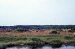
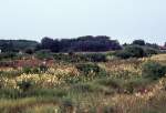
The landscape around the  Great Blue Spring,  located in the  Rold Skov  (forest) in Himmerland, not far from Arden and Skørping and 32 km south of Aalborg. - Date of capture: July 23, 1972.
The landscape around the "Great Blue Spring," located in the "Rold Skov" (forest) in Himmerland, not far from Arden and Skørping and 32 km south of Aalborg. - Date of capture: July 23, 1972.
Kurt Rasmussen

D䮥mark / Nordjylland / Landschaften

576 1200x786 Px, 20.05.2014

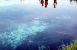
The water in  Store Blåkilde,  i.e., in the  Great Blue Spring,  is actually blue. - Date: July 23, 1972.
The water in "Store Blåkilde," i.e., in the "Great Blue Spring," is actually blue. - Date: July 23, 1972.
Kurt Rasmussen

D䮥mark / Nordjylland / Landschaften

611 1200x785 Px, 20.05.2014

The landscape around the Great Blue Spring. Date of capture: July 23, 1972.
Kurt Rasmussen

D䮥mark / Nordjylland / Landschaften

640 1200x820 Px, 20.05.2014

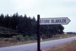
32 km south of Aalborg and near the small towns of Arden and Skørping lies the spring  Store Blåkilde  ( Great Blue Spring ) in the forest area  Rold Skov,  the second largest forest in Denmark. - Date of capture: July 23, 1972.
32 km south of Aalborg and near the small towns of Arden and Skørping lies the spring "Store Blåkilde" ("Great Blue Spring") in the forest area "Rold Skov," the second largest forest in Denmark. - Date of capture: July 23, 1972.
Kurt Rasmussen

D䮥mark / Nordjylland / Landschaften

576 1200x801 Px, 20.05.2014

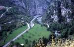
Provence-Alpes-Côte d'Azur on July 2, 1972: The former Route Nationale N204 near the village of Saorge.
Kurt Rasmussen

Provence-Alpes-Côte d'Azur: The Viaduc de Saorge was destroyed at the end of the Second World War. It was not until 1979 that the entire railway line from Nice via Sospel to Cuneo (Italy) was put back into operation. - Date of capture: July 2, 1972.
Kurt Rasmussen

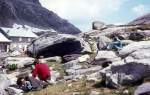
Department Alpes-Maritimes on July 2, 1972: Refuge des Merveilles.
Kurt Rasmussen

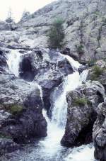
Alpes-Maritimes department on July 2, 1972: Waterfall near the Refuge des Merveilles.
Kurt Rasmussen

Alpes-Maritimes Department on July 2, 1972: The landscape near the Refuge des Marveilles.
Kurt Rasmussen

Alpes-Maritimes Department on July 2, 1972: Lac Long Supérieur (Refuge des Merveilles).
Kurt Rasmussen

Alpes-Maritimes Department on July 2, 1972: Lac Long Supérieur (Refuge des Merveilles).
Kurt Rasmussen

Department Alpes-Maritimes on July 2, 1972: In the Vallon de la Minière between St-Dalmas-de-Tende and the Refuge des Merveilles (Vallée des Merveilles).
Kurt Rasmussen

Alpes-Maritimes Department on July 2, 1972: Vallon de la Minière.
Kurt Rasmussen

Alpes-Maritimes Department on July 2, 1972: Vallon de la Minière.
Kurt Rasmussen

Department Alpes-Maritimes on July 2, 1972: The landscape in the Vallon de la Minière between Saint-Dalmas-de-Tende (a town located on the railway line Cuneo (Italy) - Breil-sur-Roya (France) - Ventimiglia (Italy) / Nice) and the Refuge des Merveilles (Vallée des Merveilles).
Kurt Rasmussen