
landschaftsfotos.eu Linie landschaftsfotos.eu
Hello guest, you are not logged in. Log in | Create account 
Forum   Contact   Legal notice
German English 

Photos by Jürgen Vos
45 Photos
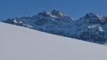
View from a plateau near Ennetbühl/Rietbad (SG) towards the Alpstein massif with the Säntis peak at 2502 m (12.02.2022)
Jürgen Vos

During the snowshoe hike to the 1520 m high Spicher (AR) view of the Alpstein massif with the 2502 m high Säntis (12.02.2022)
Jürgen Vos

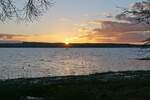
The sun sets behind the fir trees of the Bodanrück. Lake Überlingen, near Uhldingen-Mühlhofen, 30.01.2022
Jürgen Vos

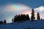
Iridescent clouds over the 1370 m high Lank, a mountain in the Bregenz Forest, on 10.01.2015
Jürgen Vos

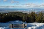
View from the 1370 m high Lank, a mountain in the Bregenz Forest, over the eastern part of Lake Constance (10.01.2015)
Jürgen Vos

Austria / Vorarlberg / Bregenz Forest

434 1200x800 Px, 08.02.2017

Winter 2016/17 and part of the Gnadensee has frozen over again (28.01.2017).
Jürgen Vos

Germany / Baden-Württemberg / Lake Constance

461 1200x705 Px, 05.02.2017

Hardly any ice skaters have passed over the trapped air bubbles yet. One day later, this view through the ice to the lakebed would no longer have been possible. Gnadensee, 28.01.2017.
Jürgen Vos

Germany / Baden-Württemberg / Lake Constance

495 1200x800 Px, 05.02.2017

Waves frozen into ice. Lake Constance, 28.01.2017.
Jürgen Vos

Germany / Baden-Württemberg / Lake Constance

436 1200x800 Px, 05.02.2017

Waves frozen into ice. Lake Gnadensee, 28.01.2017.
Jürgen Vos

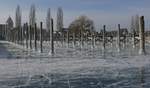
Lakeside view of the marina on the island of Reichenau on 28.01.2017.
Jürgen Vos

Germany / Baden-Württemberg / Lake Constance

411 1200x705 Px, 05.02.2017

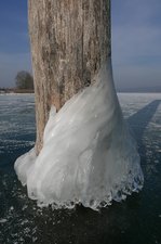
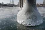
Waves, water droplets, and the cold shaped the formation on the mooring post of the yacht harbor on the island of Reichenau (28.01.2017).
Jürgen Vos

Germany / Baden-Württemberg / Lake Constance

388 666x1000 Px, 05.02.2017

We called the ice formation 'Elephant's Foot'. Mooring post in the marina of Reichenau Island on 28.01.2017.
Jürgen Vos

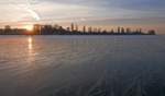
Then, shortly before sunset, the sun finally broke through the veil clouds. Mild temperatures and rain are forecasted. That’s probably the end of the walkable/drivable ice on Lake Gnadensee in winter 2016/17 (29.01.2017).
Jürgen Vos

Germany / Baden-Württemberg / Lake Constance

410 1200x706 Px, 05.02.2017

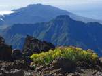
View from the 2426 m high Roque de los Muchachos to the 1857 m high Pico Bejenado and the 14 km long mountain range of the Cumbre Vieja in the background, located in the southern part of the island of La Palma (October 2013).
Jürgen Vos

Spain / Canary Islands / La Palma

640 1024x768 Px, 23.10.2013

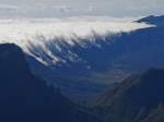
View from Roque de los Muchachos over the Caldera de Taburiente to the clouds moving from the east coast over the mountain range of Cumbre Nueva (La Palma, October 2013).
Jürgen Vos

Spain / Canary Islands / La Palma

560 1024x768 Px, 23.10.2013

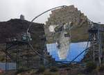
The world is upside down - The surface of one telescope reflects the second telescope. The telescopes are located on the Roque de los Muchachos at over 2200 m altitude on the island of La Palma (October 2013).
Jürgen Vos

Spain / Canary Islands / La Palma

651 1024x746 Px, 23.10.2013

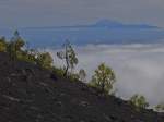
View from the slope of Volcán Martín towards the cloud-covered eastern side of La Palma and the island of Tenerife in the background with the 3718 m high Pico del Teide (October 2013).
Jürgen Vos

Spain / Canary Islands / La Palma

600 1024x767 Px, 23.10.2013

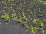
Black sandy, pine-covered slope of the Volcán Martín, La Palma, October 2013.
Jürgen Vos

Spain / Canary Islands / La Palma

599 1024x768 Px, 23.10.2013

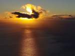
In the light of the rising sun and towering through the cloud cover, the 3718 m high Pico del Teide of the island of Tenerife can be seen. The shot was taken from the district of Las Caletas, located below Fuencaliente (La Palma, September 2013).
Jürgen Vos

Spain / Canary Islands / La Palma

779  4 1024x765 Px, 19.10.2013

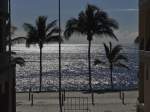
Off-season and deserted beach promenade in Puerto Naos, La Palma in September 2013.
Jürgen Vos

Spain / Canary Islands / La Palma

568 1024x768 Px, 19.10.2013

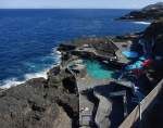
The Charco Azul ( Blue Pool ) seawater swimming pool in San Andrés. At high tide and strong waves, water exchange occurs in this seawater swimming pool (La Palma, September 2013).
The Charco Azul ("Blue Pool") seawater swimming pool in San Andrés. At high tide and strong waves, water exchange occurs in this seawater swimming pool (La Palma, September 2013).
Jürgen Vos

Spain / Canary Islands / La Palma

690 1024x810 Px, 19.10.2013

View from the 1922 m high Pico Nambroque of the cloud-covered east coast of La Palma in September 2013.
Jürgen Vos

Spain / Canary Islands / La Palma

577 1024x768 Px, 19.10.2013

View from the flank of Pico Birigoyo on the mountain frame of the Caldera de Taburiente. Rising from the clouds is the 1857 m high Pico Bejenado. La Palma, September 2013.
Jürgen Vos

Spain / Canary Islands / La Palma

719  1 1024x768 Px, 19.10.2013

View from the beach at Porto Taverna towards the island of Tavolara. South of Olbia/Sardinia, October 2011.
Jürgen Vos

Italy / Islands / Sardinia

708 1024x766 Px, 12.10.2013