




Black Forest, cycling and hiking trail in the Wiesental, on the route of the narrow-gauge railway that operated from Schopfheim to Todtnau until 1968, July 2020
(ID 40690)
Black Forest, cycling and hiking trail in the Wiesental, on the route of the narrow-gauge railway that operated from Schopfheim to Todtnau until 1968, July 2020
rainer ullrich 16.07.2020, 403 Views, 0 Comments * automatically translated


0 Comments, All comments
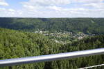
View from the pedestrian suspension bridge "Wildline" into the Enz valley and towards Bad Wildbad/North Black Forest, Sept. 2026
rainer ullrich
rainer ullrich
Germany / Baden-Württemberg / Black Forest
50 1200x800 Px, 08.10.2026
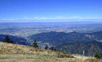
View from the 1414m high Belchen in the Southern Black Forest into the Rhine Plain and the Vosges on the horizon, Sept. 2026
rainer ullrich
rainer ullrich
Germany / Baden-Württemberg / Black Forest, Germany / Baden-Württemberg / Rhine Plain
55 1200x731 Px, 01.10.2026
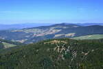
View from the Belchen in the Southern Black Forest to the 1284m high Schauinsland, Freiburg's local mountain, Sept. 2026
rainer ullrich
rainer ullrich
Germany / Baden-Württemberg / Black Forest
55 1200x800 Px, 01.10.2026
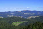
View from the Belchen to the highest Black Forest peak, the 1492m high Feldberg, Sept. 2026
rainer ullrich
rainer ullrich
Germany / Baden-Württemberg / Black Forest
53 1200x800 Px, 01.10.2026


