




Winter hiking trail between Hohfluh (2227m above sea level) and Moosfluh (2335m above sea level).
(ID 10582)
Winter hiking trail between Hohfluh (2227m above sea level) and Moosfluh (2335m above sea level).
(January 2009)
Christine Wohlfahrt http://klein-aber-fein---imagination.startbilder.de/ 06.02.2009, 774 Views, 0 Comments * automatically translated


0 Comments, All comments

Switzerland / Canton of Valais / Aletsch Glacier
273 773x1200 Px, 12.01.2022
Aletsch Glacier 2009
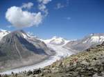
View from the Eggishorn of the Great Aletsch Glacier, which, with its approximately 23 kilometers in length, is the largest and longest glacier in the Alps.
Hans-Rudolf Stoll
View from the Eggishorn of the Great Aletsch Glacier, which, with its approximately 23 kilometers in length, is the largest and longest glacier in the Alps.
Hans-Rudolf Stoll
Switzerland / Canton of Valais / Aletsch Glacier
976 1024x768 Px, 06.08.2012

Switzerland / Canton of Valais / Aletsch Glacier
1623 660x1024 Px, 23.01.2011

Switzerland / Canton of Valais / Aletsch Glacier
992 1024x660 Px, 23.01.2011


